Chesapeake Bay Watershed
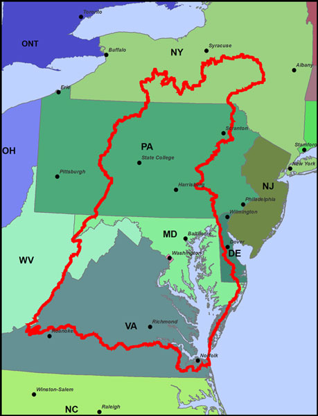
The Chesapeake Bay watershed is 64,299 square miles in size and includes parts of Maryland, Virginia, West Virginia, Delaware, Pennsylvania, New York, and Washington D.C.. More than 150 rivers and streams drain into the Chesapeake Bay.
In the 1970s, the Federal Government sponsored a $27 million, five year study to analyze the rapid loss of living resources that was devastating the Bay. The study identified an oversupply of nutrients as the main source of the Bay’s degradation. The publication of these initial research findings in the early 1980s led to the creation of the Chesapeake Bay Program as the means to restore this exceptionally valuable resource.
In 1983, the states of Maryland, Virginia, Pennsylvania, and Washington DC, joined into a regional partnership for the purpose of protecting and restoring the Chesapeake Bay. This partnership is known as the Chesapeake Bay Program. Efforts are made toward restoring water quality, restoring habitat, managing fisheries, protecting watersheds, and providing education.
Activities within the Chesapeake Bay watershed have an impact on water quality in the Bay. The Chesapeake Bay Program encourages localities in the watershed to develop watershed management plans that address the protection and restoration of stream corridors, riparian forest buffers, and wetlands.
About the Bay – Learn about the Chesapeake Bay
What You Can Do – Things you can do to protect the Bay
Chesapeake Bay Map – See a map of the Chesapeake Bay region