Weather and Tides
Chesapeake Bay Weather
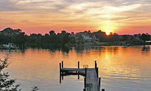
This page contains Chesapeake Bay weather and tides information, including NWS Chesapeake Bay marine forecasts and links to real-time meteorological and tides information from data buoys located throughout the Chesapeake Bay.
The weather is important. Sometimes bad weather can just be an inconvenience, but other times, like when you’re out on the water, it can be dangerous. Never go out on the bay without checking the weather forecast. Storms can roll through the Chesapeake quickly and thunderstorms can be fierce.
Even if the forecast is for nice weather, it’s good to know about wind strength and direction, particularly if you’re planning on sailing.
And, of course, anyone who’s spent time on the Bay knows that you need to be aware of high and low tides.
Maryland Forecasts:
Maryland Chesapeake Bay Small Craft Advisories
NWS forecasts for the Maryland portion of the Chesapeake Bay – For the Maryland portion of the Chesapeake. Current weather conditions, forecasts, and warnings from the Baltimore/Washington Field Office of the National Weather Service. Provides a text forecast, storm warning map, radar and satellite images, and current hourly weather observations.
Virginia Forecasts:
Virginia Marine Weather Messages from the Wakefield NOAA office
NWS forecasts for the Virginia portion of the Chesapeake Bay – For the Virginia portion of the Chesapeake. Current weather conditions, forecasts, and warnings from the Wakefield regional office of the National Weather Service. Easy to navigate, map-based user interface. Provides a text forecast, storm warning map, radar and satellite images, and current hourly weather observations.
Hurricane Season Forecasts:
National Hurricane Center – The latest hurricane season weather information from the National Weather Service.
Marine Forecasts
Chesapeake Bay Marine Forecasts: The National Weather Service’s marine forecast for eight Chesapeake Bay regions. The best source for up-to-date information on Chesapeake Bay weather conditions.
Wind Forecasts

Chesapeake Bay Wind Forecasts: Check out this National Weather Service website that forecasts wind conditions in the Chesapeake Bay. A great resource for sailors.
Tide Predictions

View Chesapeake Bay tide tables. Select a region from the list below to choose your tide table location.
- Maryland Tide Tables from Saltwater Tides
- Virginia Tide Tables from Saltwater Tides
- Maryland, Chesapeake Bay Tide Tables.
Chesapeake Bay Current Conditions
Up to the minute conditions in the Chesapeake Bay, including tide height and direction, water temperature, salinity, wind speed and direction, and currents. Provided by NOAA.
Chesapeake Bay Water Temperature Maps

Chesapeake Bay water temperatures vary from lows in mid 30’s during the winter to highs in the mid 80’s during the summer. Water temperature affects fish populations in the Chesapeake Bay. This is a good resource to use to gauge where certain species of fish might be found throughout the year.
- Coastal Water Temperature Map. Provided by NOAA.
Chesapeake Bay Marine Data from the National Data Buoy Center
View current conditions from about 30 different data buoys located around the Chesapeake Bay and tributaries. Information displayed includes wind direction, wind speed, atmospheric pressure, air temperature, and dew point. Select a data buoy from a map of Chesapeake Bay buoys.
Chesapeake Bay Interpretive Buoy System
NOAA’s Smart Buoys provide real-time weather and water observations and interpret locations along the Captain John Smith Chesapeake National Historic Trail. There are three buoys in place at this time, they are located in the James River, at the mouth of the Potomac River, and in the Patpsco River, near Baltimore. Information from these buoys is available online or by calling 1-877-Buoy-Bay.
Chesapeake Bay Interpretive Buoy System Data Page. View current information from each of the buoys.
Sea Nettle Distribution Predictions
Ouch! Sea Nettles, or jellyfish, can ruin a day on the water. NOAA has produced a map that predicts where sea nettles are likely to be found, based on current environmental conditions. Sea Nettle Distribution Predictions Map.
(Last we checked the sea nettles forecast program had been temporarily suspended while a problem with the program is being fixed)
Weather Calculators
The Washington Post Weather Calculators page These weather calculator help you convert weather factors such as Fahrenheit to Celsius, Knots to MPH, plus you can calculate wind chill and heat index.
NOAA Chesapeake Bay
The National Oceanic and Atmospheric Administration’s Chesapeake Bay Office. Includes observations from around the Chesapeake and articles about “hot topics” affecting the Bay.